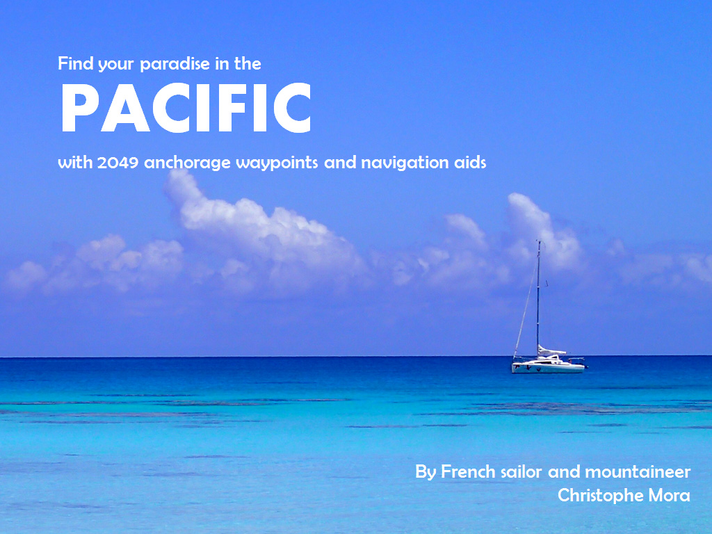
€35 South Pacific 2049 WPTS
The South Pacific Ocean, especially its western part, offers sailors an incredible amount of possible routes and stops. In this maze of islands one will inevitably encounter «crossroads» with the important question of which way to go:
- Once in French Polynesia, would you venture off the beaten track to sail south to the Australs, and if so, would you dare visit Rapa in the windswept 30s?
- On a westbound ride with the tradewinds, how would you sail to Fiji: via the Southern Cooks, Niue and Tonga or via the Northern Cooks, Samoa and Wallis?
- In the SW Pacific where would you spend the cyclone season: in New Caledonia, which has such a convenient location in the «soft» latitudes, though would become a potential danger zone from January till April, or in New Zealand, which although is out of the cyclone belt, expects you to brave a long windward sail with the risk of getting pasted on the way?
These aids to navigation and anchorage waypoints cover in a non-exhaustive manner the sailing passage from South America to Australasia (the Trans-Pacific) which is also affectionately known as the Coconut Milk Run. They are a compilation of information gathered from different cruising guides, blogs, word of mouth, etc. and are a fruit of three years and 15 000 nautical miles left in our ship’s wake.
Creating these .gpx files has been a step-by-step process as our voyage across the Pacifc unrolled. Although we visited just a fraction of those places on SY L’Envol, having these waypoints on our electronic charts of OpenCPN and SASPlanet was a huge advantage to any number of books sitting on the shelf. It happened several times, that already underway we would change our course and head somewhere we had not even planned to go.
After our Pacific Puddle Jump, Christophe continued work on the waypoint cloud regrouping the navigation aids and anchorage waypoints into different geographical zones. Some of them include comments in French, others in English, others are simply called by the name of the yacht that explored the spot and passed us the information. On one hand it is a raw and eclectic collection, on the other it is a ready-made data-base of cruising opportunities in the South Pacific and a smart planning tool for sailors.
Note: the Name of the waypoint will be shown on the screen. These are usually keywords and give a general overview of the available information. Many places, however, will have more information which can be accessed by opening the Properties window of the waypoint and reading the Description.
This collection of South Pacific is made of five files:
1- «WPTS Géographie.gpx» (90 KB), is a .gpx file which includes 218 waypoints in the Pacific (and elsewhere). It allows sailors to have an overview of possible destinations as a handy snapshot on their screen. Especially helpful with vector charts which, when zooming out, lose detail.
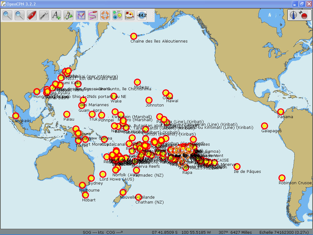
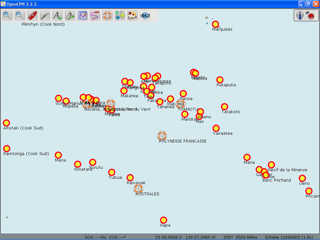
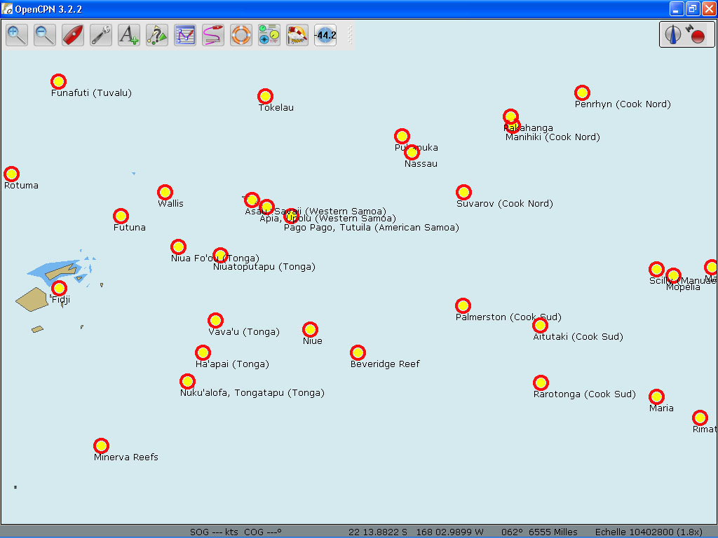
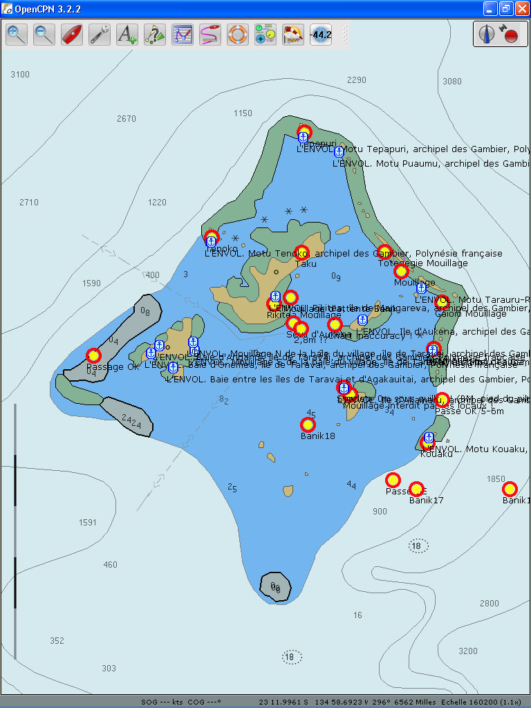
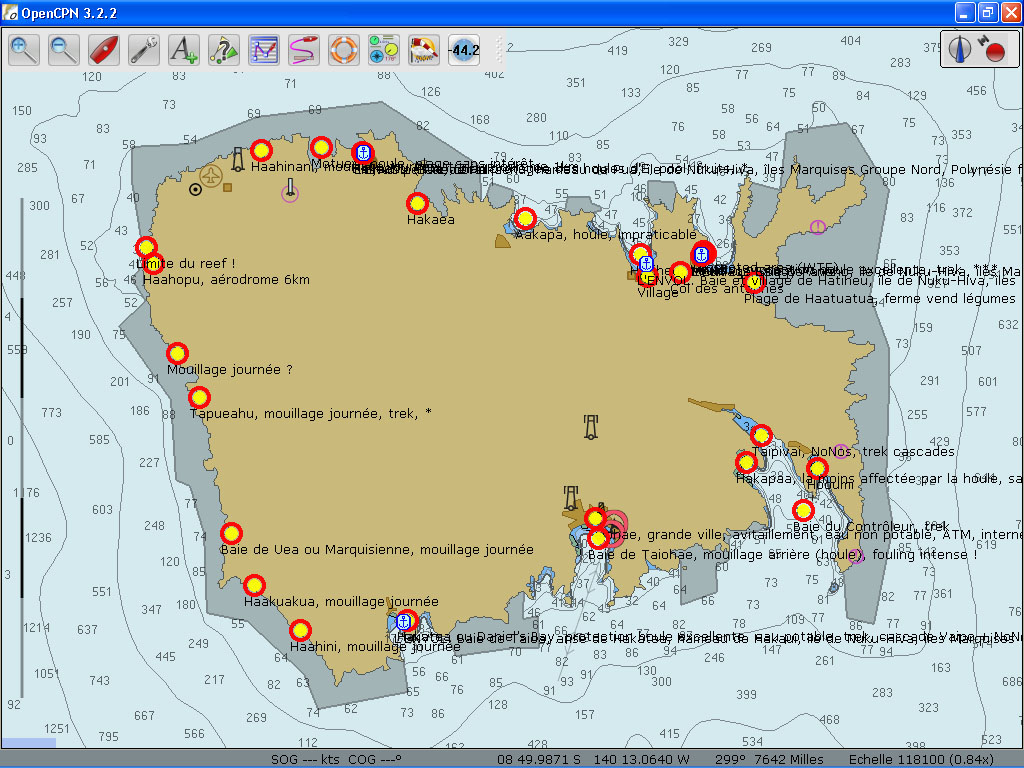
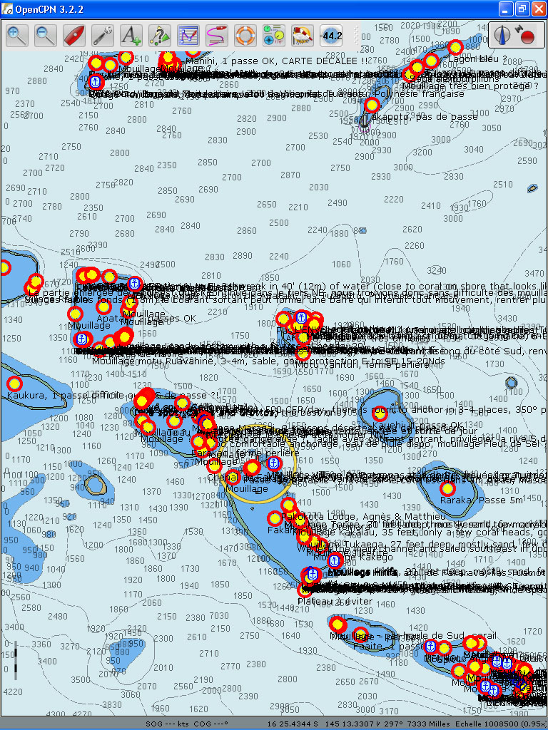
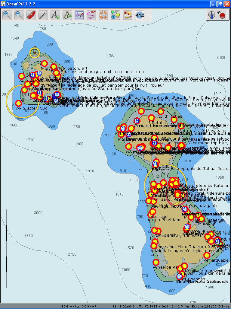
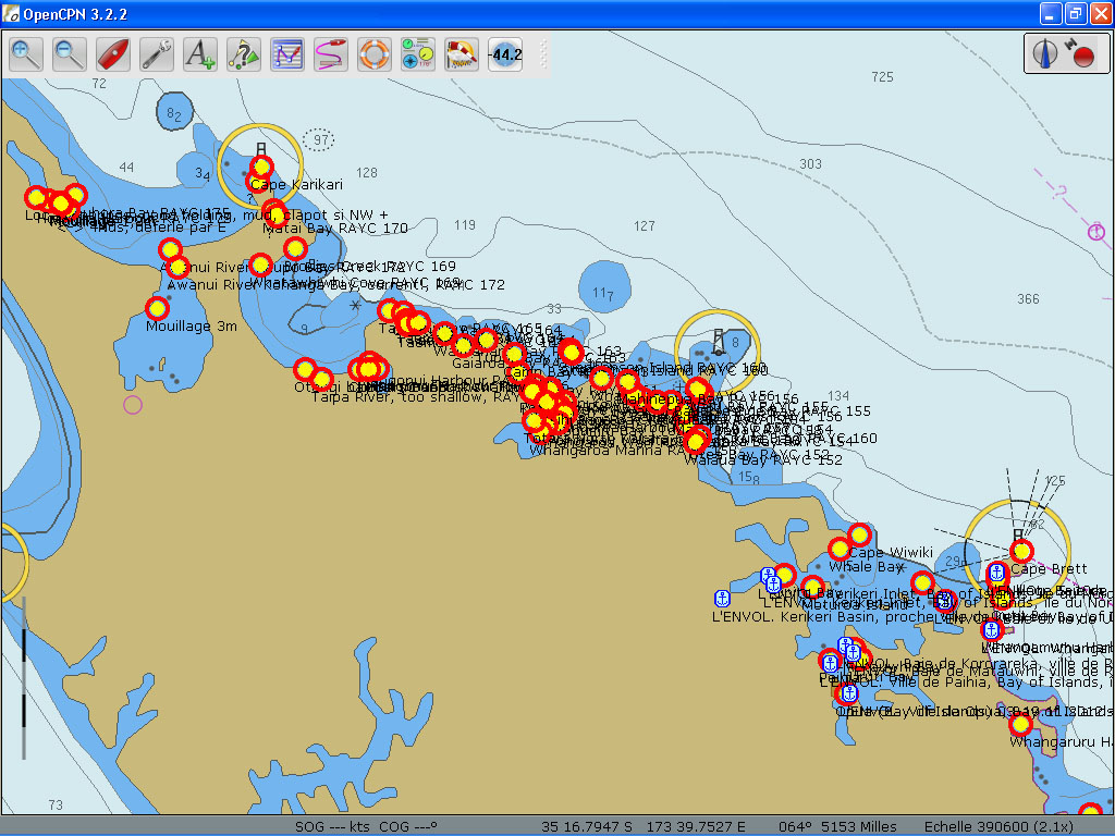
2- «WPTS Pacifique SE.gpx» (379 KB), is a .gpx file which includes 815 waypoints that cover the area between Chile and Tonga:
-Robinson Crusoe Island
-Easter Island
-Pitcairn Island
-French Polynesia (all archipelagos)
-Samoa
-Tonga (including waypoints of 60 uncharted reefs in the archipelago)
-Wallis and Futuna
To find out about SY L’Envol’s experience in South Pacific:
www.intothewind.fr/category/transpacifique/
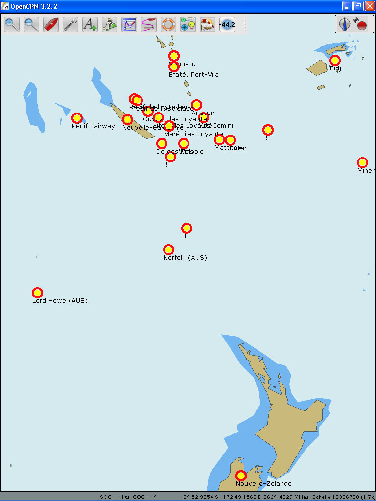
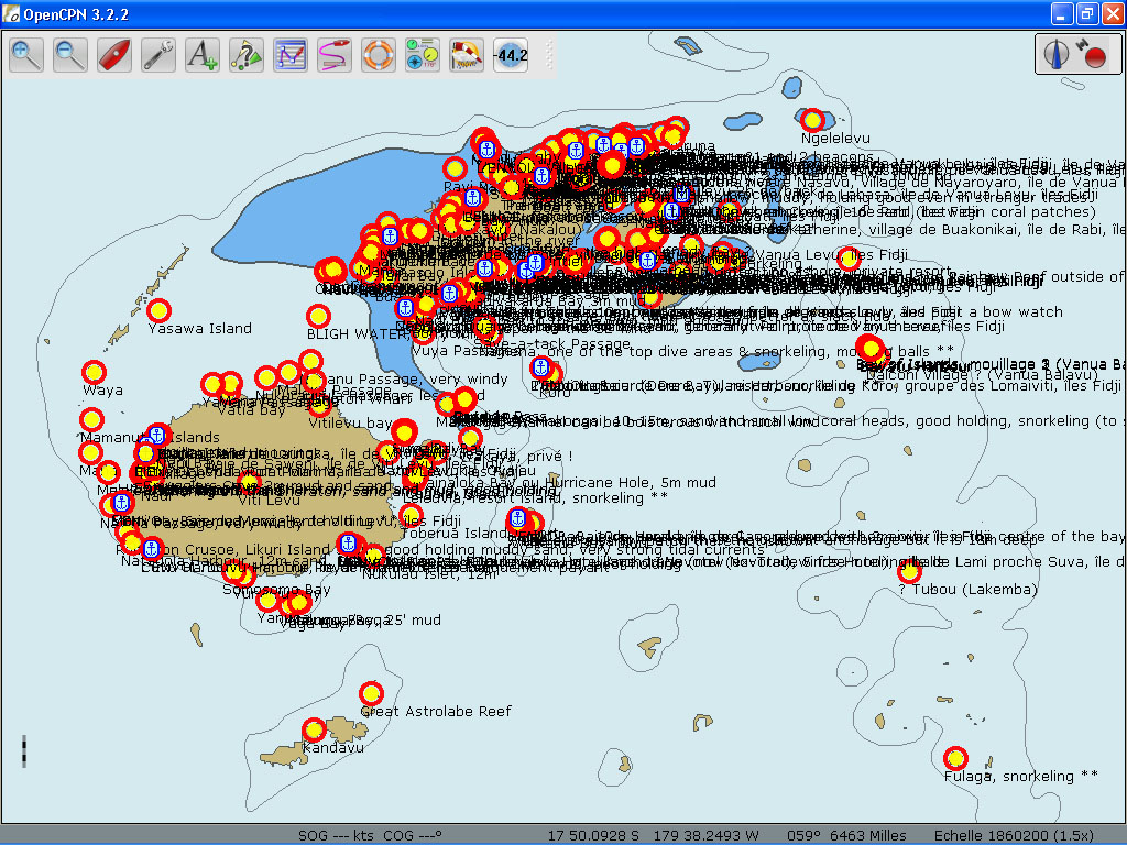
3- «WPTS Fidji.gpx» (126 KB), is a .gpx file which includes 293 waypoints in this complex constellation of island groups that the Fiji are made of. Here exploring possibilities galore but one also has to be weary of hazards like reefs and coral bommies. When there are still many uncharted areas and vector charts can often be wrong, double-checking the accuracy of the planned route and anchorage waypoints with a set of comparative satellite images has to become a habit, especially in Fiji. This is where the open-source free software, SASPlanet, steps in. Russian-made but with English language interface, it offers a possibility to access and download satellite images from different servers like: Bing, ArcGIS, Google and Yandex and many others, but these are personal favourites. Navionics and OpenTopoMaps are also available.
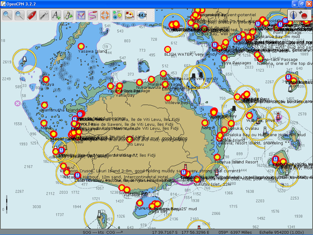
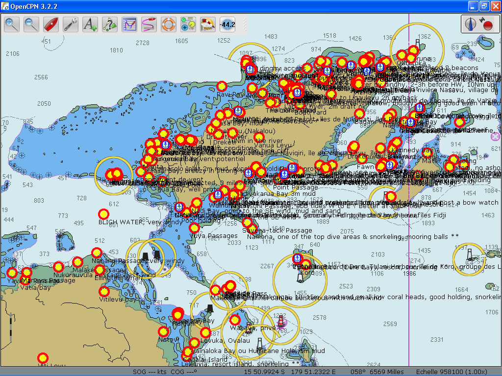
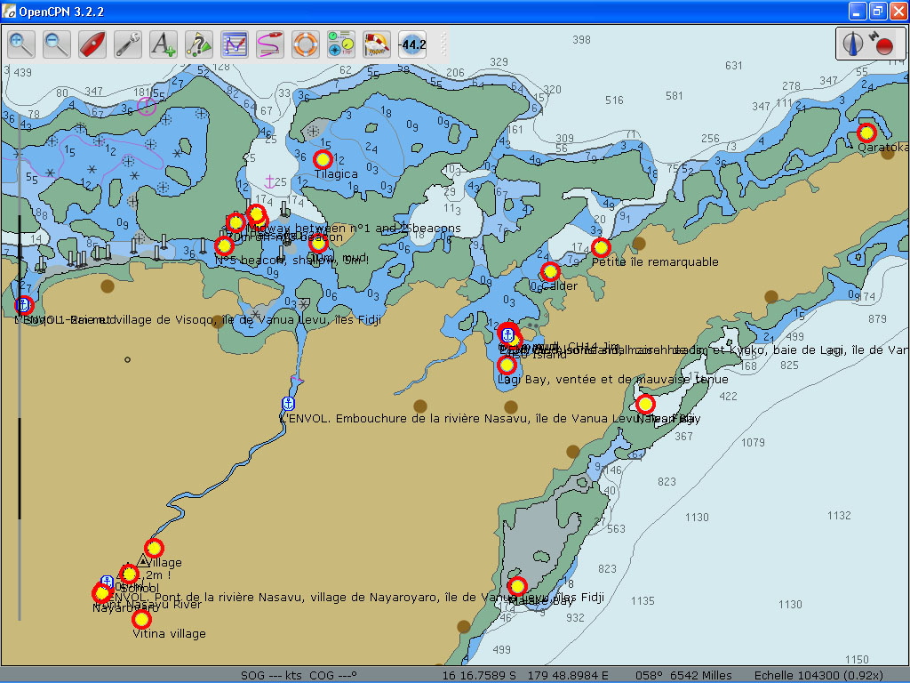
To find out about SY L’Envol’s experience in Fiji:
www.intothewind.fr/tag/fidji/
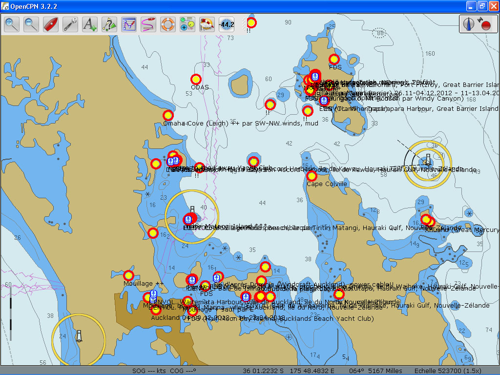
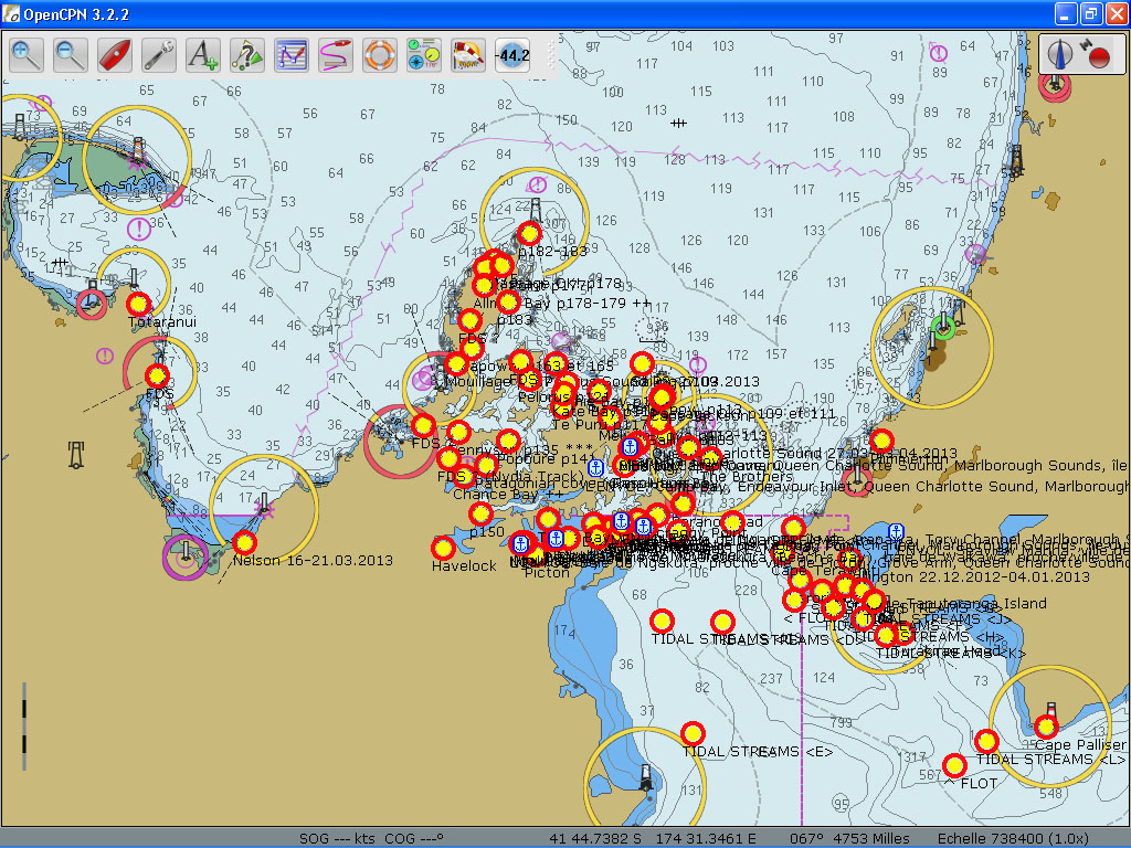
4- «WPTS NZ.gpx» (127 KB), is a .gpx file which includes 297 navigation aids and anchorage waypoints covering the North Island, the South Island and Stewart Island adding up to over 1000 nautical miles of wild coastline with all its nooks and crannies. Three main cruising grounds of Bay of Islands (Opua), Hauraki Gulf (Auckland) and the Marlborough Sounds (Cook Strait) have deserved special attention.
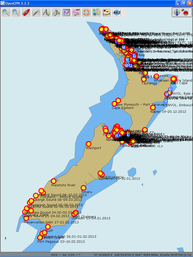
To find out about SY L’Envol’s experience in New Zealand:
www.intothewind.fr/tag/nouvelle-zelande/
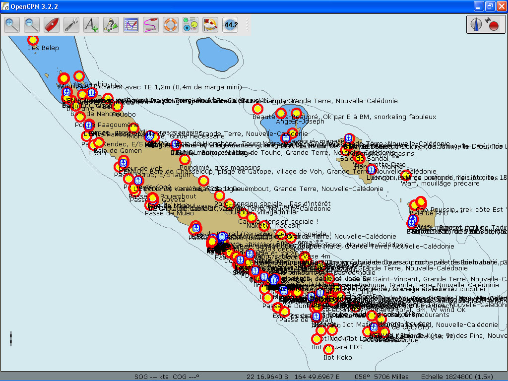
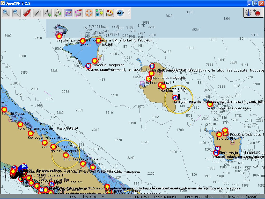
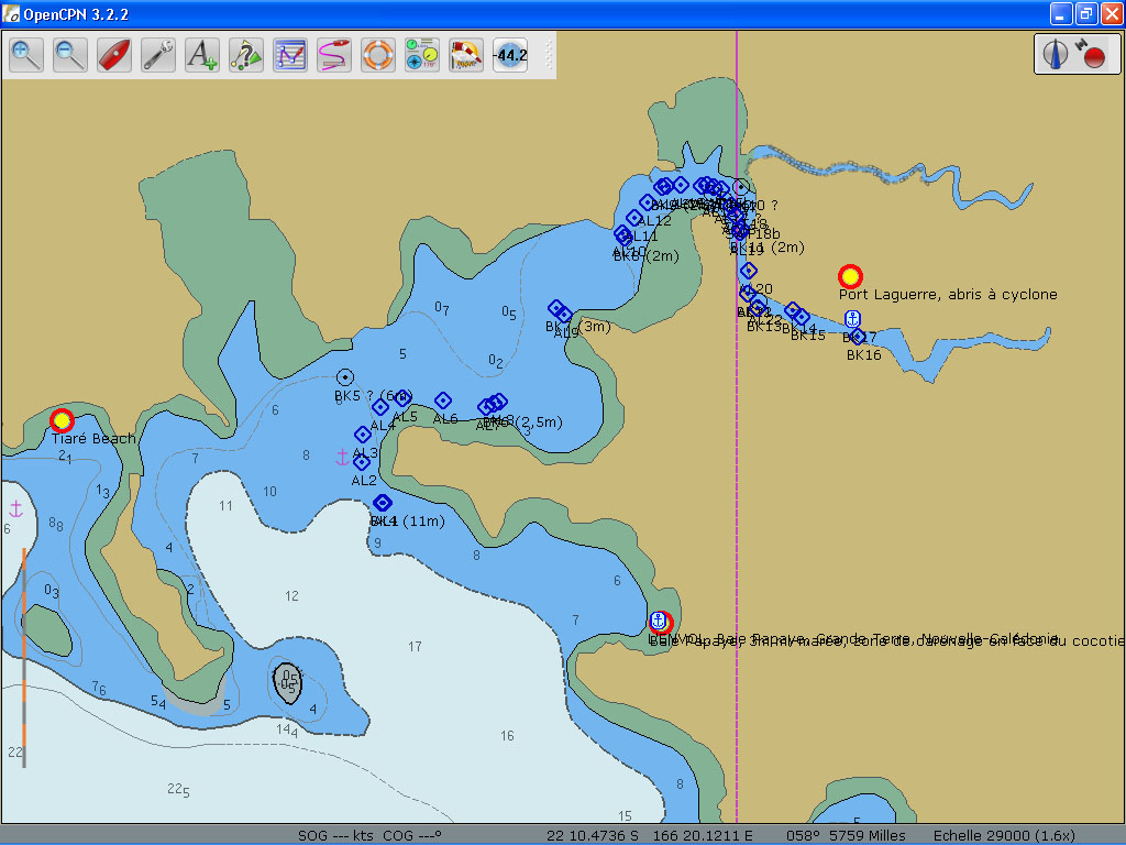
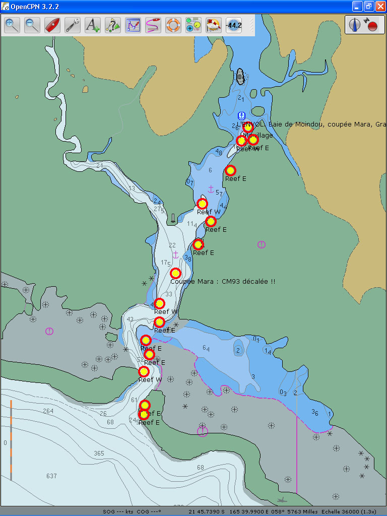
5- «WPTS NC.gpx» (177 KB), is a .gpx file which includes 426 navigation aids and anchorage waypoints in New Caledonia. From the Isle of Pines in the south, to the Belep Islands in the north, passing along the picturesque coast of Grande Terre, there are 300 nautical miles one can cruise inside the sheltered lagoon waters. Another fascinating cruising ground are the Loyalties: Mare, Lifou and Ouvea, unique in many ways but especially because of their geology. The three are raised atolls and there are very few of such islands in the world. Passing a cyclone season in New Caledonia may not be as outrageous as one may think: there are several cyclone holes and mangroves where one can take the boat to in case of an alert. Access to those places (including Port Laguerre and La Foa River) will also be given in this file.
To find out about SY L’Envol’s experience in New Caledonia:
www.intothewind.fr/tag/nouvelle-caledonie/
How to install
These .gpx files could be used in any software which can import a .gpx file.
If using OpenCPN, simply save the .gpx files in its «Layers» folder:
C:\Documents and Settings\All Users\Application Data\opencpn\Layers
or
C:\Documents and Settings\Administrator\Application Data\opencpn\Layers
Price: €35. To receive by e-mail this collection of five .gpx files amounting to 2049 navigation aids and anchorage waypoints, click on the «Donate» button below and proceed to payment via Paypal.
Thank you for supporting SY L’Envol’s journey!
All contributions received through this page will be added to the running crowdfunding project and visible here:
www.intothewind.fr/crowdfunding/
Free: our ship’s track and 175 anchorages in South Pacific (but also elsewhere) are FREE to download (as .kml files) here:
www.intothewind.fr/map-of-the-voyage/
Christophe + Carina
SY L’Envol
————–
Other .gpx files: