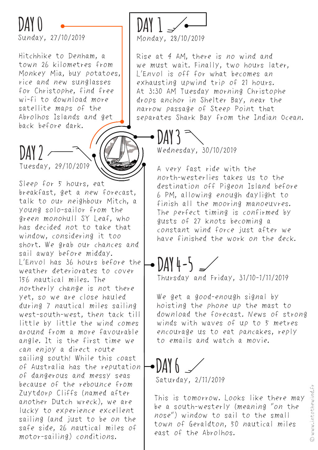
Ghosts of the Abrolhos
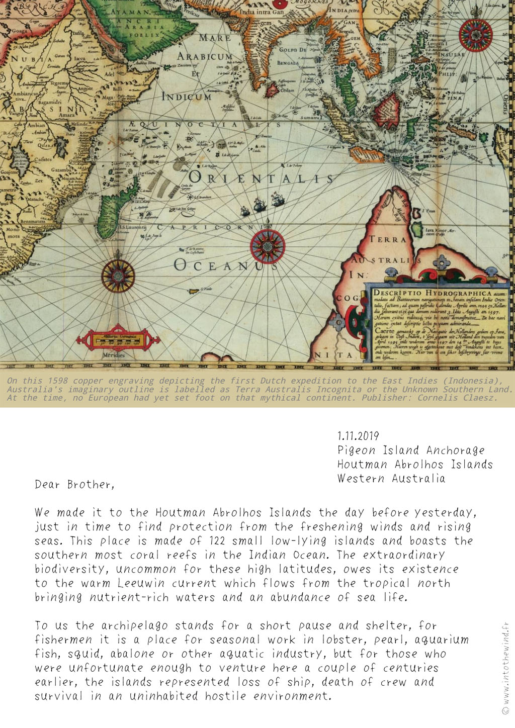
2. Lodewijcksz, Willem ?/ Claesz, Cornelis (1598). Marine chart depicting Dutch first fleet voyage to the East Indies. Amsterdam: C. Claesz. High quality image visible on Leen Helmink Antique Maps website
3. McCarthy, Mike (1981). Colonial Wrecks in the Abrolhos Islands. Report number 27. Fremantle: Western Australian Museum. PDF
4. McCarthy’s shpwreck list has been double checked for updates using Western Australia Museum Maritime Archaeology Database (December 2023)
5. Ariese, Csilla (2012). Databases of the People Aboard the VOC Ships Batavia (1629) and Zeewijk (1727). Report number 298, Western Australian Museum. Fremantle: Australian National Centre of Excellence for Maritime Archaeology. PDF
————–
Timeline. Map bibliography
Eight monochrome stamps were created using these high resolution images:
Sources of relevant information
————–
The original letter to my brother, sent from Geraldton, Australia, on the 2nd of November 2019, did not include the timeline «A Blank on the Map» nor the wreck sites map «Ghosts of the Abrolhos». These parts were added later, when in 2023 L’Envol had stopped in Brazil for a 9-months breather and I had time to plunge into further research of the subject. Published from Charlotteville, Tobago, on the 25th of January 2024, under «wrong date» for the sake of the story.