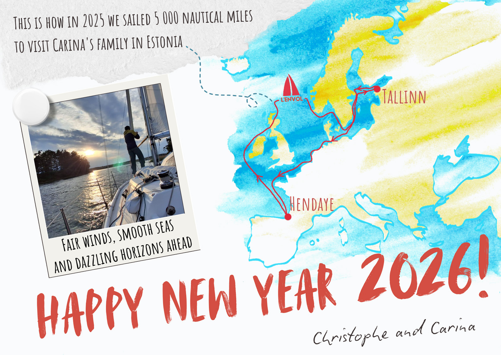
Happy New Year 2026!
Dear all,
Happy New Year 2026!
SY L’Envol and crew greet you from Hendaye in southwest France.
In 2025 our ship stretched her wings sailing North to wash up in Estonia where Carina’s parents and brother’s family live. It was an important milestone not only because after ten years of couple life Christophe was meeting his parents-in-law for the first time, but also because he had never been to Eastern Europe before.
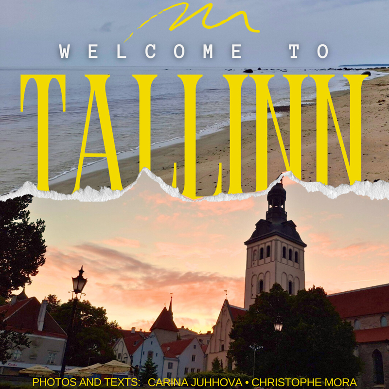
We are happy to share this experience with you! Discover a scrapbook which reveals why Carina left her home country 18 years ago, lets you have a glimpse of our surprise welcome party and provides tips on 10 places to explore in Tallinn:
Online flipbook by Carina and Christophe
After spending one month in Estonia, we took to the sea again and migrated south to winter over in milder climates.
And so L’Envol and crew have passed the test – we are still passionate about travelling under sail with the ship being our sole residence. As to the plans of 2026, then we are just as curious as you how near or far this year’s winds will take us.
We wish you all healthy, safe and happy both on land and water. Fair winds!
Christophe and Carina
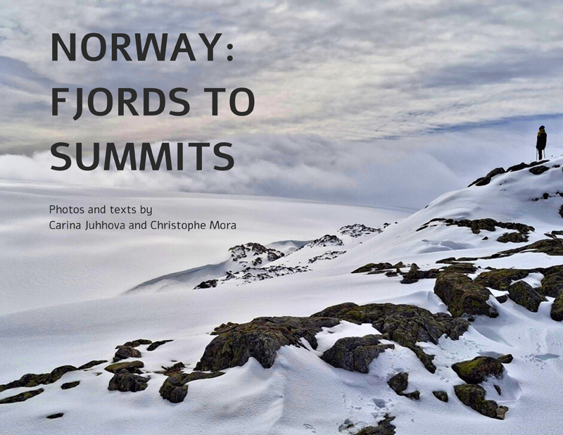
Seven PDF photologues from the 2025 trip

After the « sailboat parking lot », where L’Envol was one of a hundred masts over last winter, we enjoy being the only boat at anchor. Although it is cold, life is good under blue skies and sunshine, which according to the locals only happens once a year! The fair winds invite us to sail along the west coast of Ireland, known for its inhospitable climate and unpredictable weather.
In this lunar landscape, with few trees and even fewer forests, we are able to climb two mountains: Mount Brandon (952m) and Mweelrea (814m), two coastal peaks with breathtaking views!
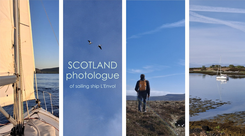
Crossing the channel between Great Britain and the Orkney Islands, the Pentland Firth, was critical. Currents of 5 knots or more pushed us towards the island of Swona on our port side. With the sails tightly trimmed, assisted by the outboard motor at full throttle, we made it through, but we were on a collision course with the island until we passed the southern tip of South Ronaldsay on our starboard side, which straightened the current behind us. Even a cargo ship, which we were able to see the track of using the VHF AIS receiver, made a significant detour.
At these latitudes of 58° North, we have daylight from 4 AM to 10:30 PM which is great because we can sleep in, meaning sleep during the day, without feeling guilty!
Everything was floating in the lockers, even the bed in the bow with its feather duvet was soaking wet. Fortunately, the computer was untouched, as we were still 24 hours away from destination. We had to bail out a lot of water underway and then continue with rinsing and drying everything in the marina and at anchor. It is the third day of cleaning. We even had to remove the floor boards to access the bilge! It has been a mammoth amount of work and a blow to morale, but the process is coming to an end and we can already breathe a little easier. Nature can be pretty harsh sometimes, but we keep returning!
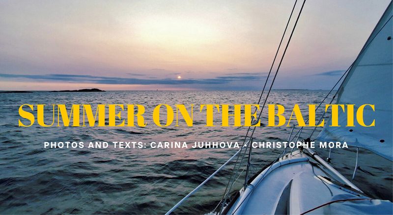
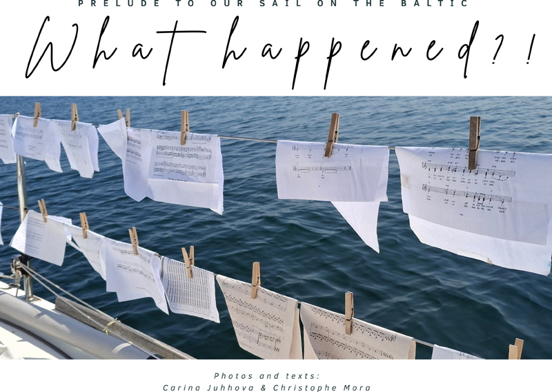
Having spent a month in Estonia, we set off again. With the prevailing south-westerly winds, leaving the Baltic Sea is more delicate, as the favourable weather windows are short and the stops therefore numerous. We discover Finland and then, once again, the east coast of Sweden.

We arrived just in time to enjoy the massive cultural event, the National Song Celebration, that takes place for one weekend in July every five years: thousands of choir singers in national costumes, an impressive crowd of smiles in the rain and mud! It was almost midnight, when we came tacking across the Bay of Tallinn, but still light, which is typical of these high latitudes (59° North). The festival flame, lit at the top of a tower, became our landmark. Although there was no-one but us to witness this moment, it felt like we were making a grand entrance.
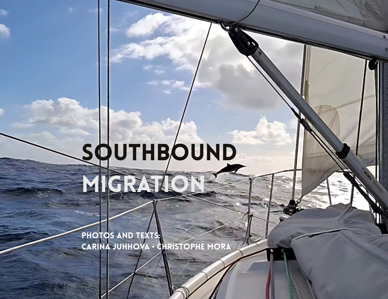
Back in the North Sea our southward migration in search of milder temperatures was slowed by several periods of bad weather. To sum up, we had to wait for two weeks in Brunsbüttel, Germany, one week in Nauerna, Netherlands, and then another week in Audierne, Brittany, to be able to sail in good conditions across the North Sea, the English Channel and the Bay of Biscay to Hendaye, our winter base camp.
During this journey, L’Envol sailed along the coasts of ten European countries, covered nearly 5’000 nautical miles (9’000 km), and made more than 90 stops. The boat also travelled through six canals with locks: the Caledonian Canal in Scotland, the access to Stockholm in Sweden, the Kiel Canal in Germany, and the canals of the Netherlands. The inland waterways add up to a total of 170 nautical miles of our overall trip, and we only used the engine for about forty nautical miles, the rest, nearly 80%, we were able to sail. On land, we will have explored over 3’000 kilometers on foot, by bicycle, hitchhiking, or using public transport.
2025 saw us develop a certain migratory pattern to avoid the harshest winter weather with the hope to return north upon the better season’s coming. Here on the Spanish border the temperatures, even during the coldest winter months, rarely drop below 10 degrees. Last year’s experience shows that it should do, and we can continue living aboard without suffering too much from cold. Let us see how we go.
————–
La trace GPS du bateau, nos traces GPS à terre (en trek, en stop…) et nos waypoints d’escales autour du monde sont visibles et téléchargeables gratuitement à partir de cette carte du voyage interactive. Sur un fond d’images satellites, vous pouvez zoomer, vous déplacer et cliquer sur les traces et les escales de L’Envol pour obtenir plus d’information.
Page publiée le 21/01/2026 depuis L’Envol, baie de Chingoudy, Hendaye, France, GPS 43 22.05 N 1 46.53 W
Envie de nous donner un coup de main ? Visites la page de financement participatif de L’Envol : www.intothewind.fr/crowd-funding/