€35 Australia 2359 WPTS
This data base of anchorage waypoints and navigation aids was created during the three years SY L’Envol sailed around Australia. Just like with the two previous projects of South Pacific Ocean crossing and sailing through Patagonia, a part of our preparation for the trip Down Under was to collect all information available and make a synthesis of it in our navigation software. Christophe would then double check the accuracy of each waypoint with high-resolution satellite imagery of SASPlanet – a software that allows not only downloading the satellite images but also plot the course between reefs and coral bommies, export (or import) .gpx files and, icing on the cake, would then show our yacht’s GPS position on the satellite map while underway without the need for mobile coverage.
Australian cruising grounds
With the quantity of miles to be sailed and places explored, this waypoint file was not a job finished in one go, but rather an ongoing eye-opening process which not only helped us complete our personal goal but showed how much more there is to Australian cruising grounds, and not just around the Great Barrier Reef, but in every corner of the country. We could probably circumnavigate Australia again without repeating any of the anchorages!
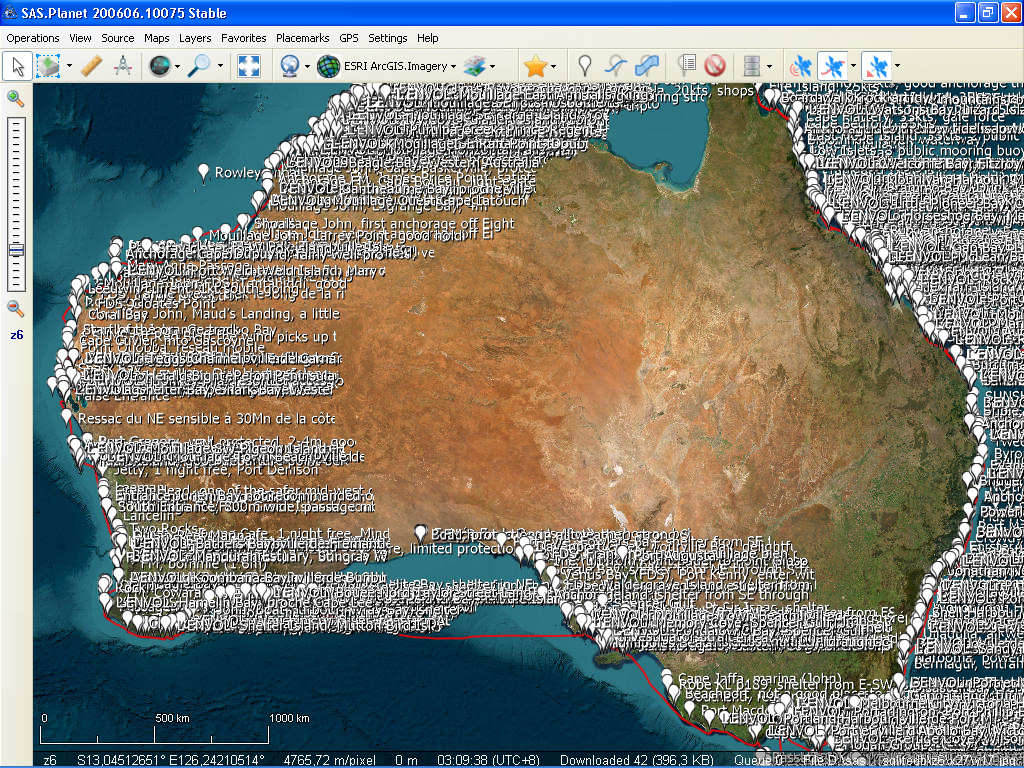
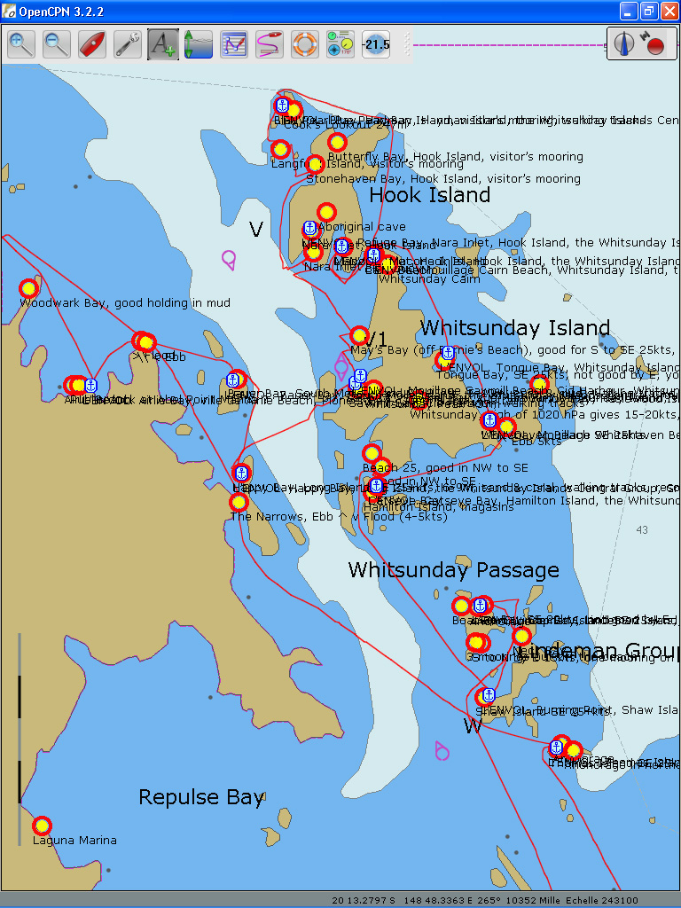
Cluster of anchorage waypoints showing all the possibilities. We only tried 230, a tiny part of these!
Unfortunately many international sailors, especially the French, choose to skip Australia and sail from New Caledonia directly to Torres Strait, probably fearing the language barrier and the officialdom. Others arrive in Brisbane or Bundaberg and then sail up the beaten track in the sheltered waters of the reef. Spending Christmas and New Years Eve in Sydney is another popular choice.
While local sailors can take a lifetime to enjoy their coastline, the foreign fleet have to worry about visas and cruising permits which luckily, though only for some nationalities, is not as complex and limiting as we had first thought. One year visas, we had applied for in advance, were easily granted and upon arrival we found out that our yacht could stay up to three years in the country.
So why not opt for the grand tour?
Australian coastline, of more than 10 000 nautical miles and stretching from latitude 44 in the south to the tropical latitude 10 at the top end of the country, has a lot to offer to cruisers, many of the places still little known to those who have sailed here from overseas. Two of our favourite discoveries have been the Kimberley Plateau – an area of magnificent red canyons with ancient rock art galleries remembering the days the Aboriginal communities inhabited the place, which lies in the northwest corner of the country, and Tasmania, which despite its chilling location in the roaring forties, has many sheltered waterways and harbours to explore, its each corner different and of stunning beauty. Both clockwise and anti-clockwise circum-navigations are practised, but watch those seasons – timing your passages along one or the other part of the coast is crucial for a safe voyage. To sail around Australia in one year is possible, but those who prefer slower pace, should consider taking two years.
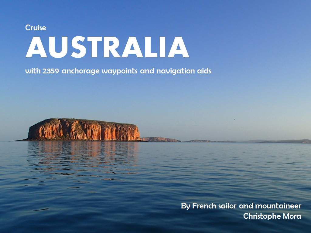
«WPTS Australie.gpx» (1.36 MB), is a .gpx file composed of 2359 navigation aids and anchorage waypoints. The information to create these files has come from 17 different nautical guides, blogs and websites but also word of mouth of many Australian sailors who shared their experiences with us. All in all, this .gpx file makes a great planning tool for sailors coming to Australia whatever their project, or for local yachties intending to sail beyond their usual cruising grounds. The information in the waypoints is given in English.
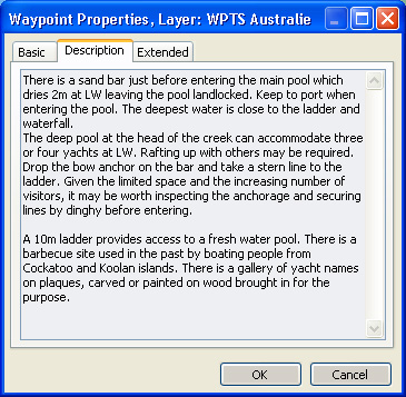
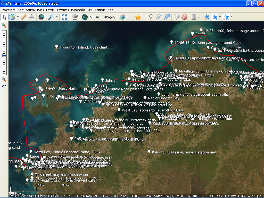
Above, description of the Crocodile Creek waypoint in the Kimberley.
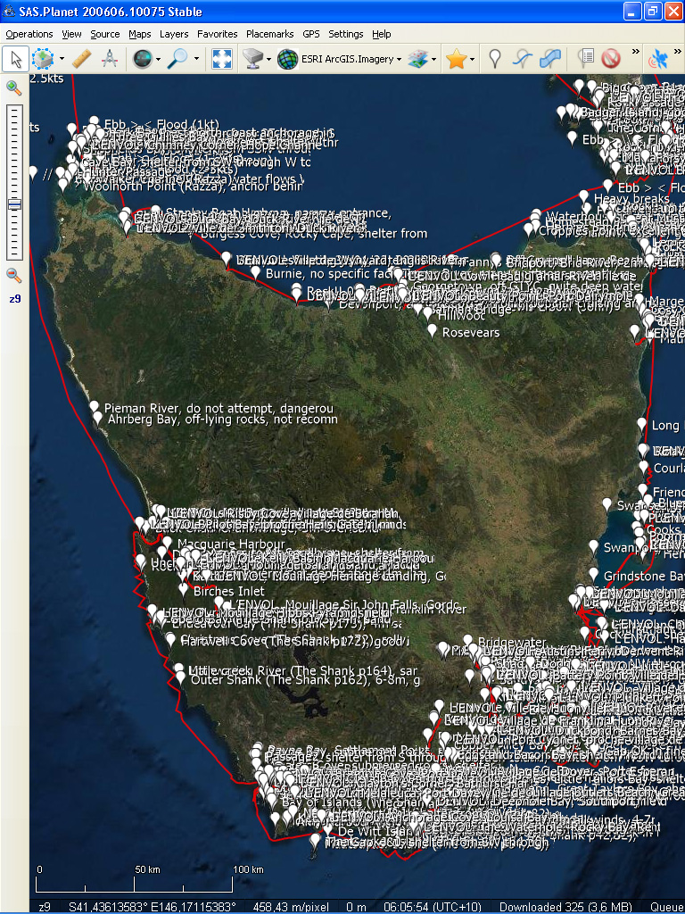
Cloud of waypoints on your screen
In softwares of OpenCPN (navigation) and SASPlanet (satellite imagery).
How to install
This .gpx file could be used in any software which can import a .gpx file.
If using OpenCPN, simply save the .gpx file in its «Layers» folder:
C:\Documents and Settings\All Users\Application Data\opencpn\Layers
or
C:\Documents and Settings\Administrator\Application Data\opencpn\Layers
Price: €35 / AUD $55. To receive by e-mail this .gpx file of 2359 navigation aids and anchorage waypoints, click on the «Donate» button below and proceed to payment via Paypal.
Thank you for supporting SY L’Envol’s journey!
All contributions received through this page will be added to the running crowdfunding project and visible here:
www.intothewind.fr/crowdfunding/
Free: our ship’s track and 230 anchorages in Australia (but also elsewhere) are FREE to download (as .kml files) here:
www.intothewind.fr/map-of-the-voyage/
Blog articles about this part of the trip:
www.intothewind.fr/planete-kimberley/
www.intothewind.fr/category/tour-de-tasmanie/
www.intothewind.fr/tag/australie/
Christophe + Carina
SY L’Envol
————–
Other .gpx files: